Kākātangiata urban growth area
Due to its close proximity to the city and strong transport connections, the Kākātangiata area has long been identified as a location with potential for future urban growth. Planning for urban growth in Kākātangiata on the city’s western outskirts has reached an important milestone after many years.
In June 2025, Council agreed to prepare a plan change to rezone the Kākātangiata area as a “Future Urban Zone”. Previous community involvement and technical advice has added to what we know about the area, and as a result, the new zone is smaller than what has been consulted on previously.
We’ll be consulting with the community on the proposed plan change soon
We’re now working to prepare a proposed Future Urban Zone plan change for the Kākātangiata area west of Palmerston North.
The proposed zone would be part of the city’s long-term growth planning and is intended to help guide future urban development in a coordinated, infrastructure-led and staged way.
It would not immediately enable urban development or residential subdivision. Instead, it would establish a planning framework to help manage future growth in the zone over time.
We are currently seeking feedback from residents and landowners in the area before we formally notify and consult on the proposed plan change.
What the growth area looked like
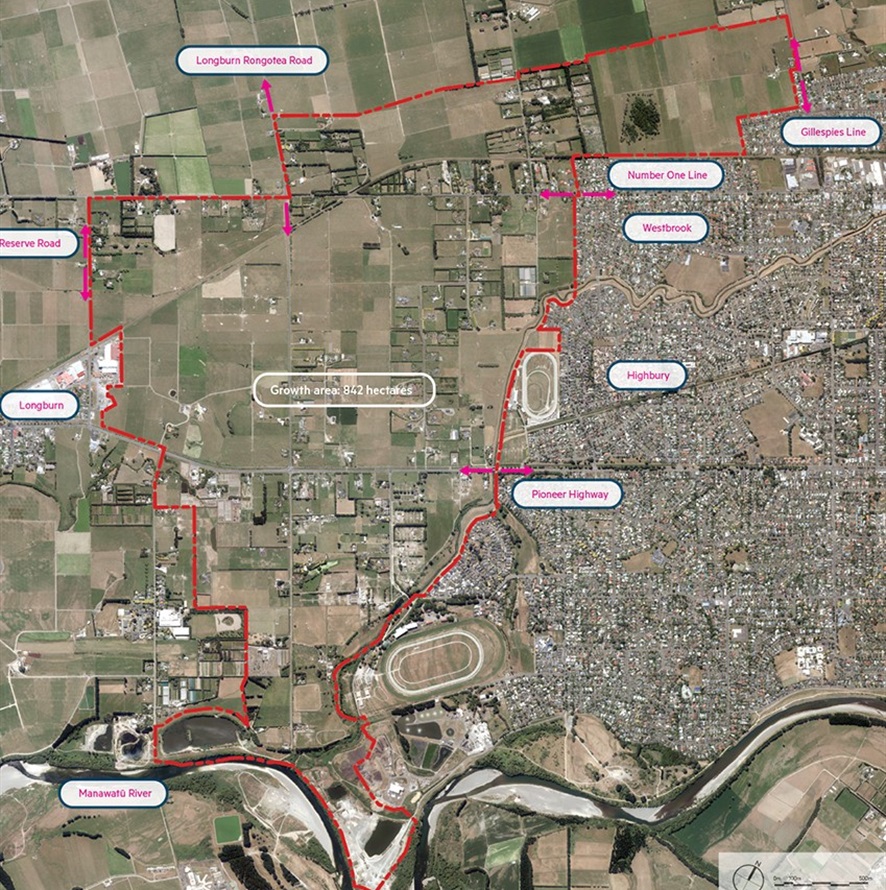
The previous growth area is marked in red on the map. The proposed Future Urban Zone will be significantly smaller and have its own structure plan.
Next steps
Once the details of the proposed change are ready, we will seek approval from Council to consult formally on this proposed District Plan change. The draft of this plan will then be notified for consultation, during which time you can have your say by making a submission. You’ll also be able to speak to your submission in front of a hearing panel that will include elected members.
The hearing panel will then make a decision on any changes to the plan change based on what they have heard. There will then be an appeal period once this decision is released. Any appeals would be mediated or responded to in the Environment Court.
If the proposed plan change is accepted at that stage, the Kākātangiata urban growth area will be rezoned from rural to residential within the District Plan. Any development would be likely to happen in stages over time and be driven by both private landowners and our ability to build infrastructure to meet the needs of new housing in the area.