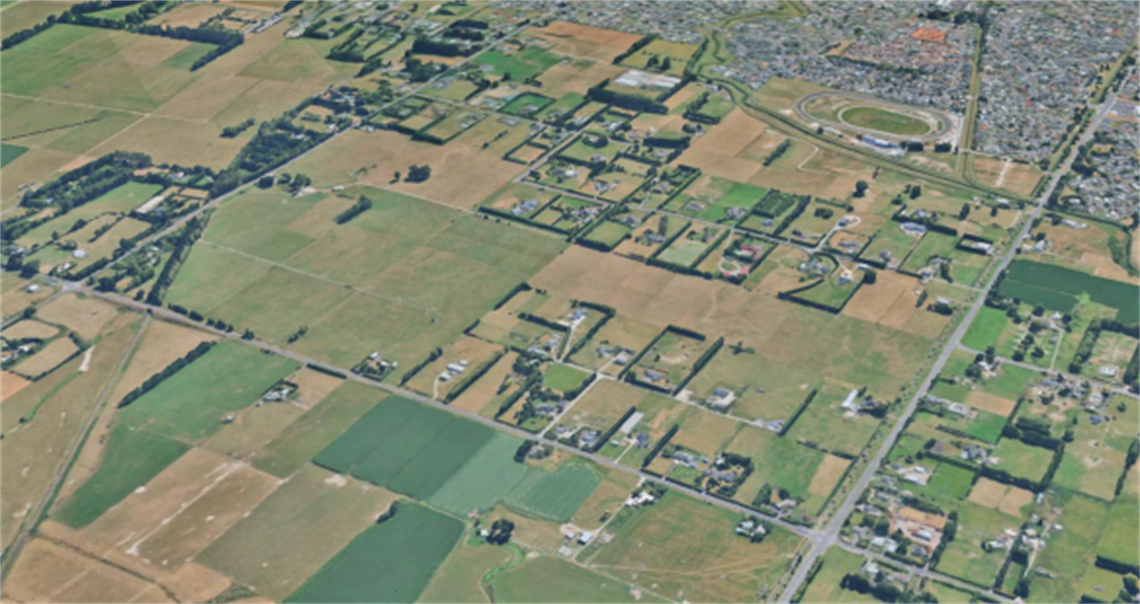
Help shape the future of Kākātangiata. We're proposing to change around 302 hectares of land on Palmerston North's western edge from Rural Zone to Future Urban Zone, and we want to hear what you think.
The proposed Future Urban Zone would not immediately allow urban development or residential subdivision. Instead, it would provide a framework to guide future growth, while allowing existing rural land uses to continue.
Make a submission
What we're proposing
Proposed Plan Change H: Kākātangiata Future Urban Zone would rezone land on the city's western outskirts to guide how the area develops over time.
Kākātangiata has long been identified as an important area for future growth because of its location next to the existing city and its connections to the wider transport network.
Creating a Future Urban Zone would help ensure any future development is planned and connected, rather than happening in separate, disconnected areas. This includes planning for transport connections, infrastructure, stormwater management, open spaces and community facilities.
The planning framework also includes Whānau Ora principles developed with Rangitāne. These bring together the cultural values of Mana Whenua and the wellbeing of the wider community, including restoring the environment, connecting waterways and green spaces, and creating places for recreation.
Read the Kākātangiata Future Urban Zone fact sheet (PDF)(PDF, 1MB)
The proposed Kākātangiata Structure Plan
The proposed Future Urban Zone includes an area-wide Structure Plan that shows how different parts of Kākātangiata could connect and develop in future.
The Structure Plan identifies the broad location of:
- Transport connections, including the main urban connector, collector roads and links to surrounding areas.
- Waterways and open spaces, providing opportunities for recreation, environmental restoration and stormwater management.
- Local shops and community facilities, providing space for services that could support a growing community.
- Stormwater management, identifying areas and infrastructure needed to manage stormwater as the area develops.
- Cultural and environmental features, recognising and protecting important values and features.
Individual developments would be likely to happen progressively over time, rather than all at once. The Structure Plan would serve as a guide for more detailed planning as different parts of Kākātangiata are developed.
The proposed Kākātangiata Future Urban Zone sits on the city's western edge, between Awapuni and Longburn, extending from Pioneer Highway to No. 1 Line.
More about the proposal
Explore the information below to understand how the proposal has developed and what it could mean for the area.
Why we're planning for future growth in Kākātangiata
Future Urban Zones identify land intended for future urban development, while providing a framework to make sure that development is coordinated and properly supported by infrastructure.
For Kākātangiata, this would help Council and future developers plan how roads, stormwater systems, waterways, open spaces and community facilities could work together.
It would also help ensure future development connects with surrounding areas and takes account of cultural and environmental values.
How we got here
Council has been planning for future urban growth at Kākātangiata for several years, including through the Kākātangiata Urban Growth Area Masterplan prepared in 2023.
That earlier work considered a much larger growth area and provided an initial framework for future development.
Since then, we've carried out further investigations into:
- Stormwater management, flooding and natural hazards.
- Transport connections.
- Ecological and environmental values.
- Infrastructure requirements.
- How future development could be delivered.
In June 2025, Council agreed to a revised approach, starting with a Future Urban Zone. As a result of the technical investigations, the proposed growth area was reduced to approximately 302 hectares.
During June and July 2026, we sought feedback from landowners, residents, stakeholders and the wider community. Feedback from Rangitāne o Manawatū has also helped shape the planning framework.
Following this engagement and further technical work, Council approved Proposed Plan Change H for public notification on 14 October 2026.
What this means for landowners and developers
Most of the land within Kākātangiata is privately owned. Any future development would generally be led by landowners and developers over time.
Some landowners have indicated an interest in future development, but the proposed Future Urban Zone would not itself allow urban development or residential subdivision.
Future proposals to enable urban development would need to go through separate plan change processes. These would include technical assessments, consideration of environmental effects and opportunities for public submissions.
Development is likely to happen progressively over many years.
The proposed Future Urban Zone would not require landowners to develop their land or change their existing rural land use.
Previous Kākātangiata Urban Growth Area Masterplan
The 2023 Kākātangiata Urban Growth Area Masterplan considered a substantially larger area for future urban development.
Further investigations into infrastructure, flooding, stormwater and environmental matters have resulted in a smaller proposed Future Urban Zone.
The map below shows the earlier growth area compared with the revised proposal.
Supporting documents and reports
These documents provide further detail about Proposed Plan Change H, including the proposed planning provisions, technical assessments, engagement reports and land title information.
Future Urban Zone supporting documents (16 files)
- 01. Kākātangiata Future Urban Zone – Section 32 Evaluation Report(PDF, 4MB)
- 02. Kākātangiata Future Urban Zone – Structure Plan(PDF, 11MB)
- 03. Kākātangiata Future Urban Zone – Objectives and Policies(PDF, 691KB)
- 04. Kākātangiata Future Urban Zone – Appendix A: Development Area and Structure Plan Guidance(PDF, 549KB)
- 05. Kākātangiata Future Urban Zone – Appendix B: Stormwater Management Requirements(PDF, 565KB)
- 06. Kākātangiata Future Urban Zone – Strategic Transport Assessment(PDF, 4MB)
- 07. Kākātangiata Future Urban Zone – Structure Plan Methodology Statement(PDF, 1MB)
- 08. Kākātangiata Future Urban Zone – Engagement Summary Report(PDF, 2MB)
- 09. Kākātangiata Future Urban Zone – Stormwater Servicing Assessment(PDF, 21MB)
- 10. Kākātangiata 2023 Masterplan – Summary of Technical Reports(PDF, 4MB)
- 11. Rangitāne Whānau Ora Outcomes Framework Report(PDF, 4MB)
- 12. Rangitāne Future Urban Zone Draft Structure Plan and Provisions Feedback(PDF, 5MB)
- 13. Kākātangiata Future Urban Zone – Cultural Values Assessment(PDF, 21MB)
- 14. Kākātangiata Future Urban Zone – TATEC Response to Clause 3B Consultation Report(PDF, 10MB)
- 15. Kākātangiata Future Urban Zone – Legal Descriptions and Certificates of Title(PDF, 13MB)
- 16. Kākātangiata Future Urban Zone – Certificates of Title(ZIP, 31MB)
Make a submission
You can make a formal submission on Proposed Plan Change H: Kākātangiata Future Urban Zone under Schedule 1 of the Resource Management Act 1991.
Anyone can make a submission in accordance with the Resource Management Act 1991, subject to the statutory restrictions relating to trade competition.
Submissions close at 4pm on Friday 18 December 2026.
Complete the online form below to make a submission.
Make a submission online
Submissions will help inform Council's consideration of the proposed plan change, including whether any changes should be made.